
Monday 9th Feb - Antiques, Jewellery, Militaria, Coins, Vinyl, Toys, Ceramics, Collectables & More
Monday 9th Feb - Antiques, Jewellery, Militaria, Coins, Vinyl, Toys, Ceramics, Collectables & More
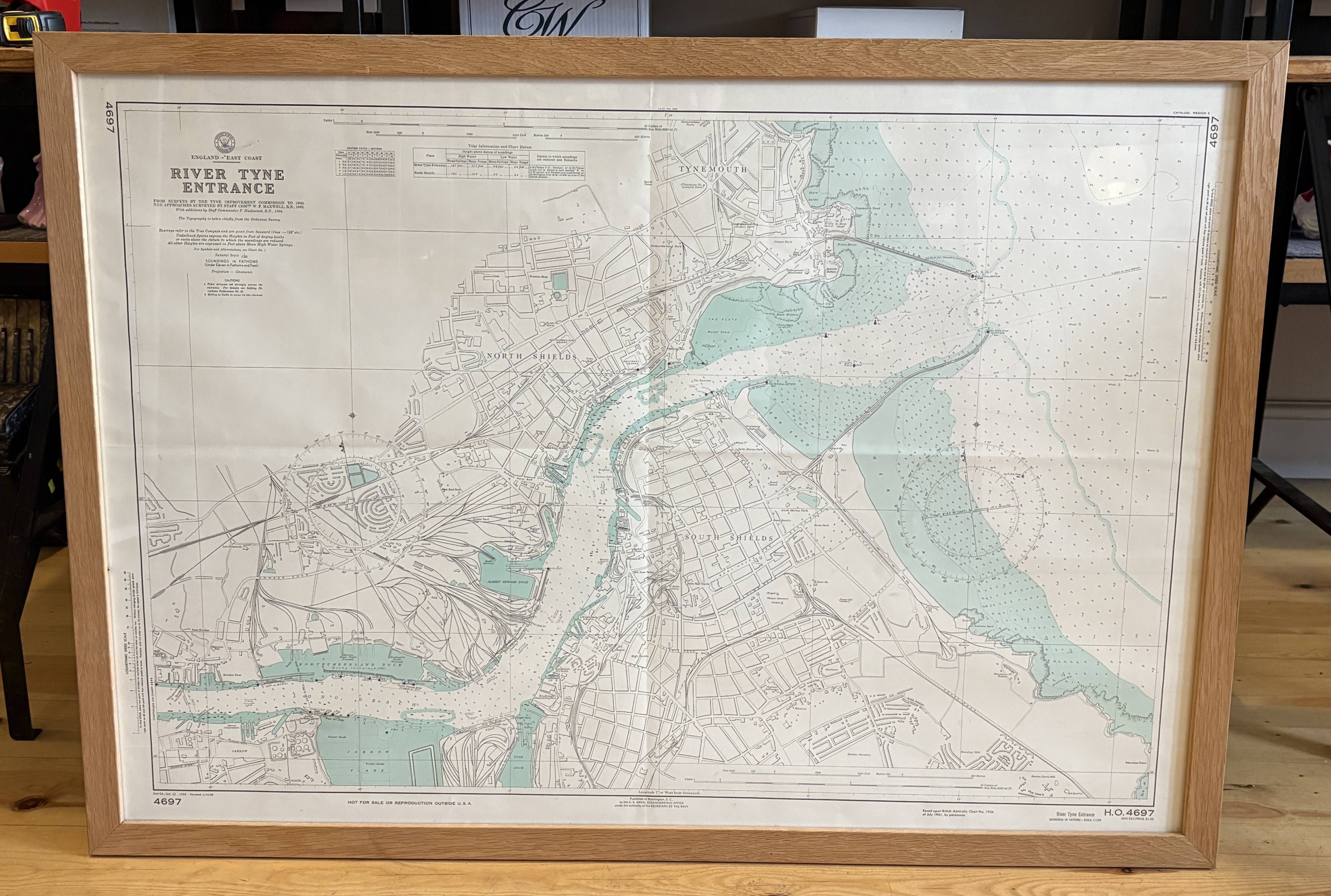
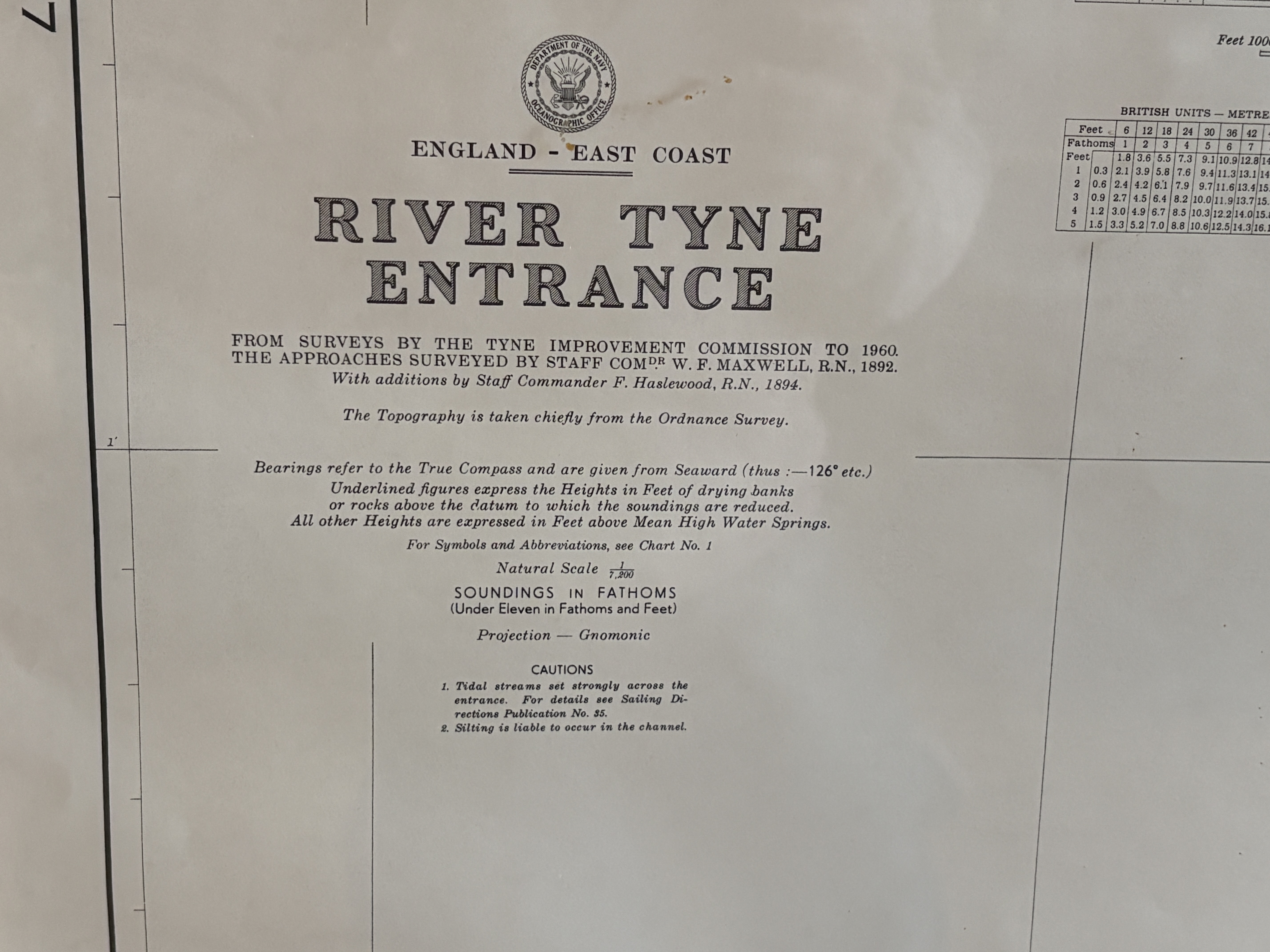
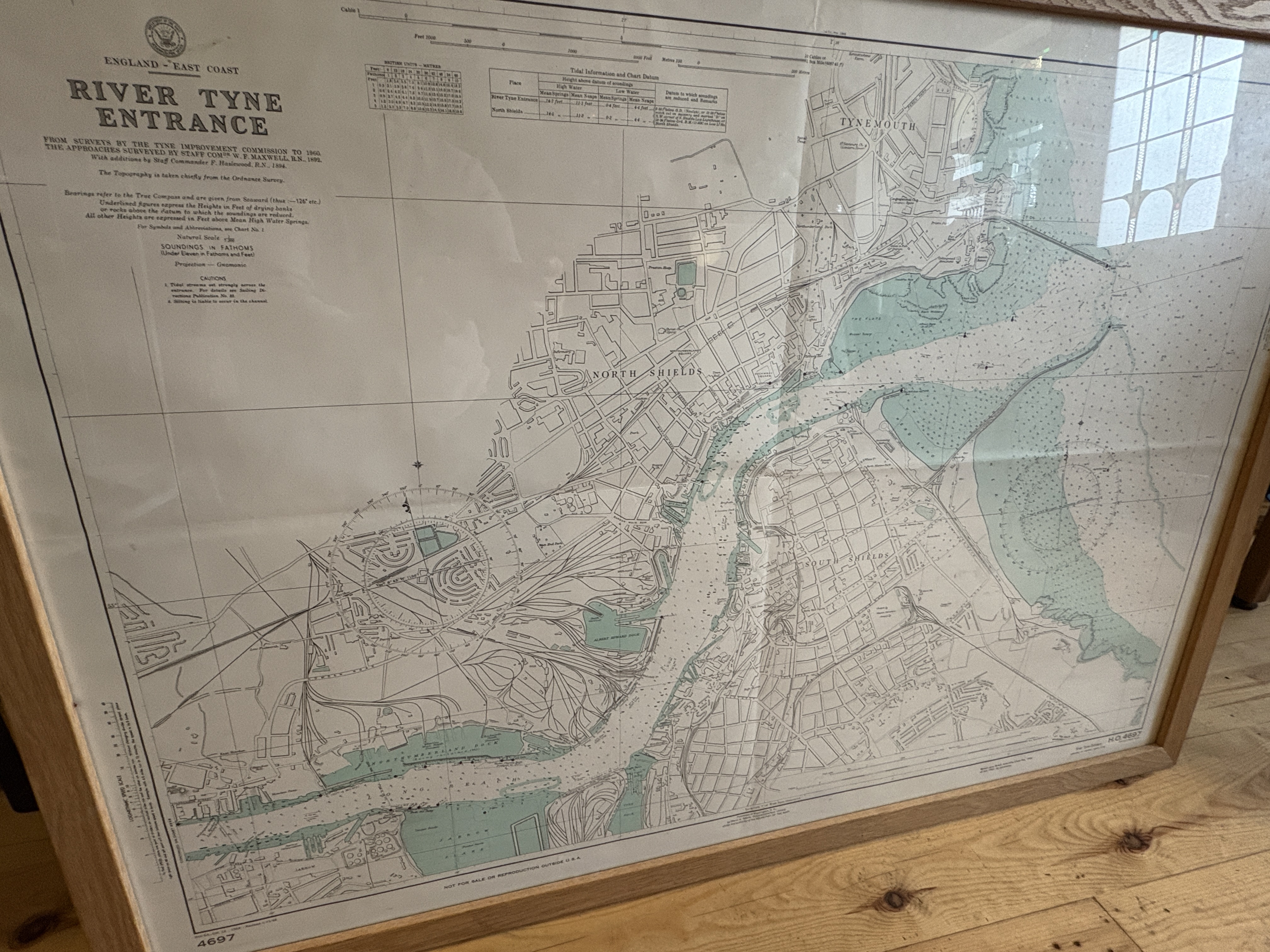
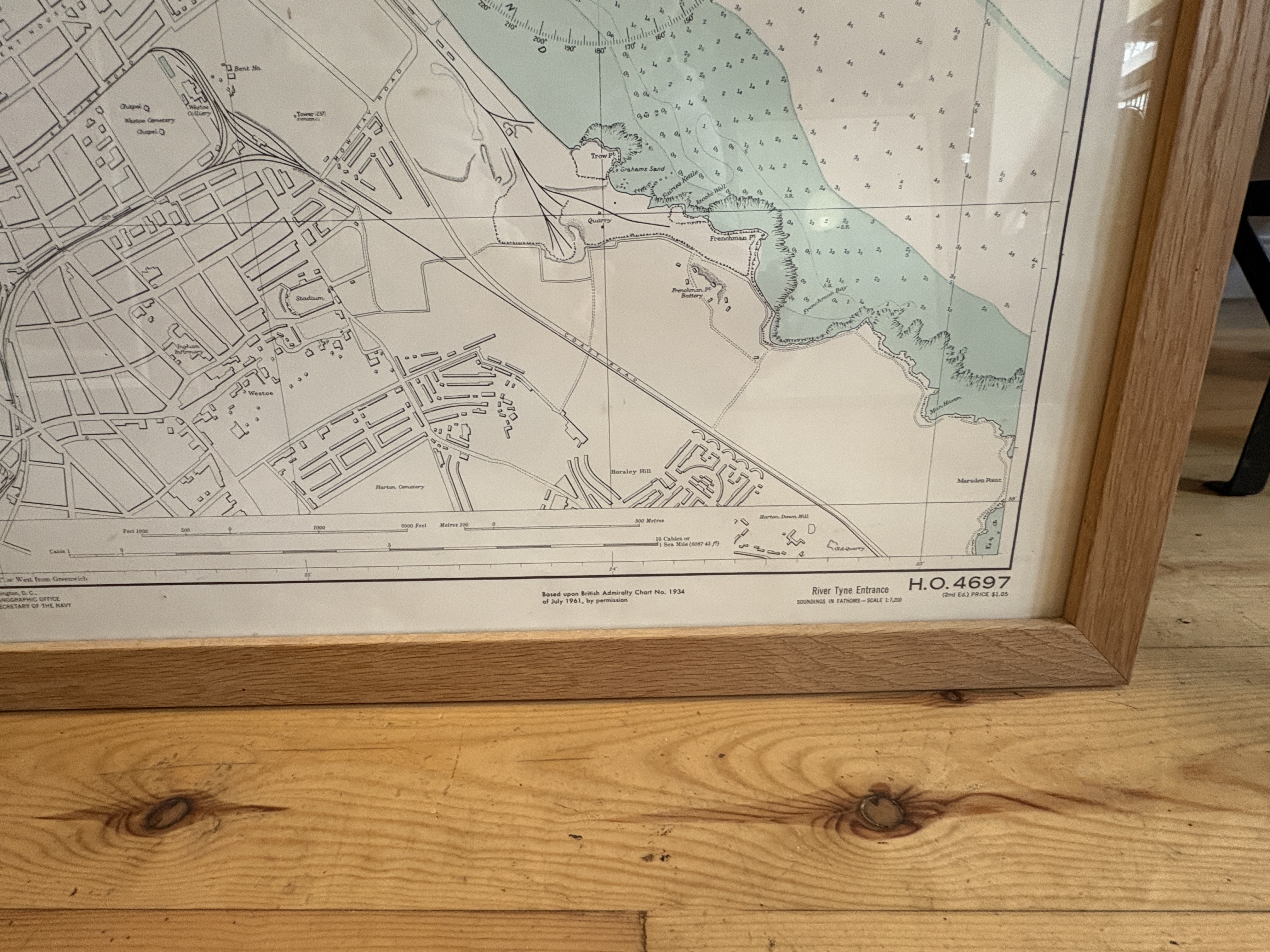
A large-format vintage nautical chart detailing the entrance to the River Tyne on the Northeast Coast of England, showing the confluence point of North Shields and Tynemouth. Published by the U.S. Department of the Navy (Hydrographic Office, Chart No. H.O. 4697). This specific printing is based upon British Admiralty Chart No. 1934 of July 1981, indicating a production date sometime after July 1981. The chart synthesizes extensive historical survey data, including primary surveys by the Tyne Improvement Commission (to 1960) and earlier approaches surveyed by Staff Commander W. F. Maxwell, R.N. (1892), with additions by Staff Commander F. Haslewood, R.N. (1894). The topography is chiefly taken from the Ordnance Survey. Content includes depth soundings (in fathoms and feet), built-up areas, and navigational cautions, rendered at a natural scale of 1:7,200. The chart is printed in black, white, and pale blue-green ink (used for water and depth contours). It is professionally mounted and sealed within a sturdy, modern, light oak wooden frame behind protective glazing, ready for display. No provenance marks, bookplates, or ownership inscriptions noted.
Measurement: 111 x 78 CM
Share this lot: