
Monday 9th Feb - Antiques, Jewellery, Militaria, Coins, Vinyl, Toys, Ceramics, Collectables & More
Monday 9th Feb - Antiques, Jewellery, Militaria, Coins, Vinyl, Toys, Ceramics, Collectables & More
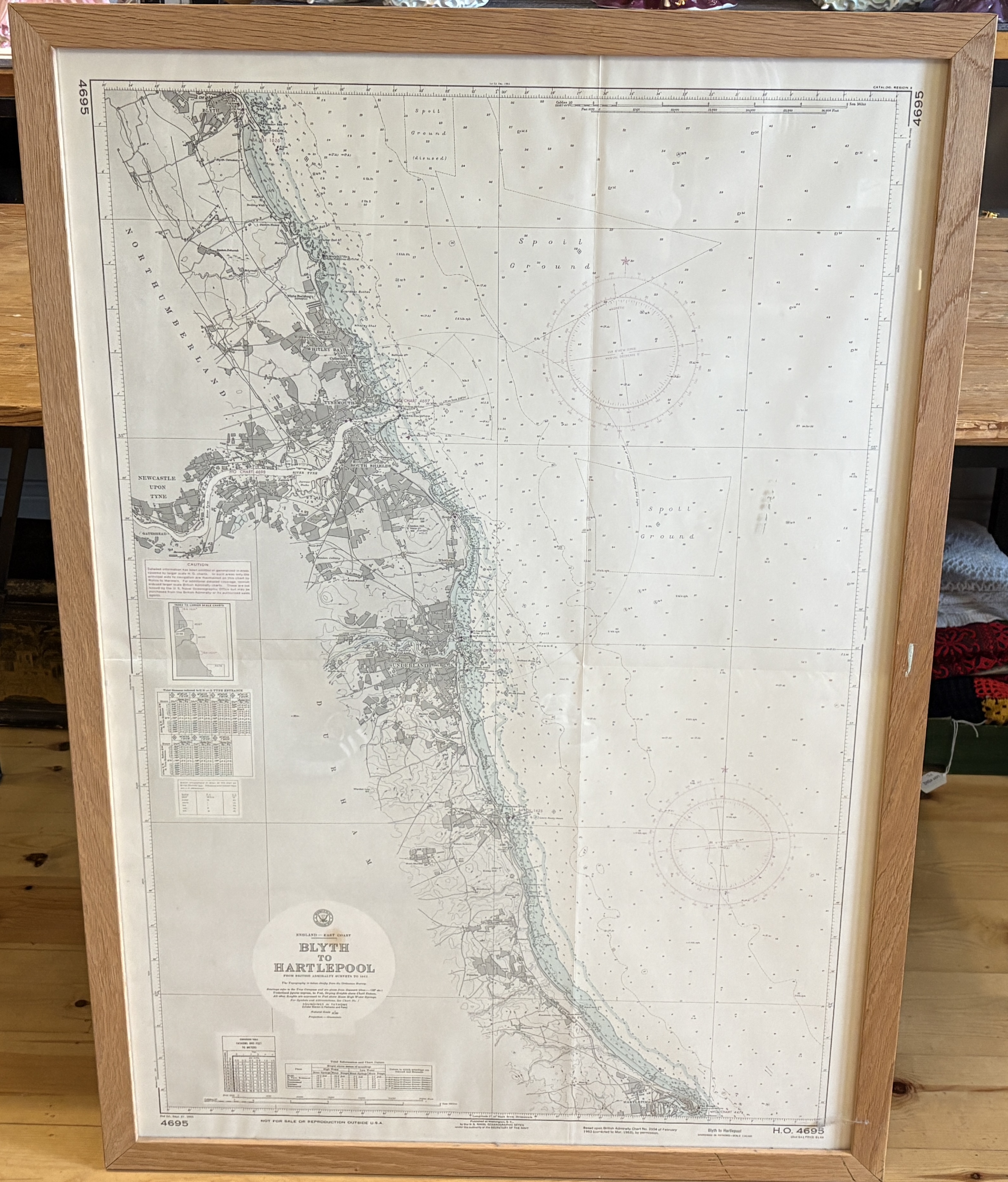
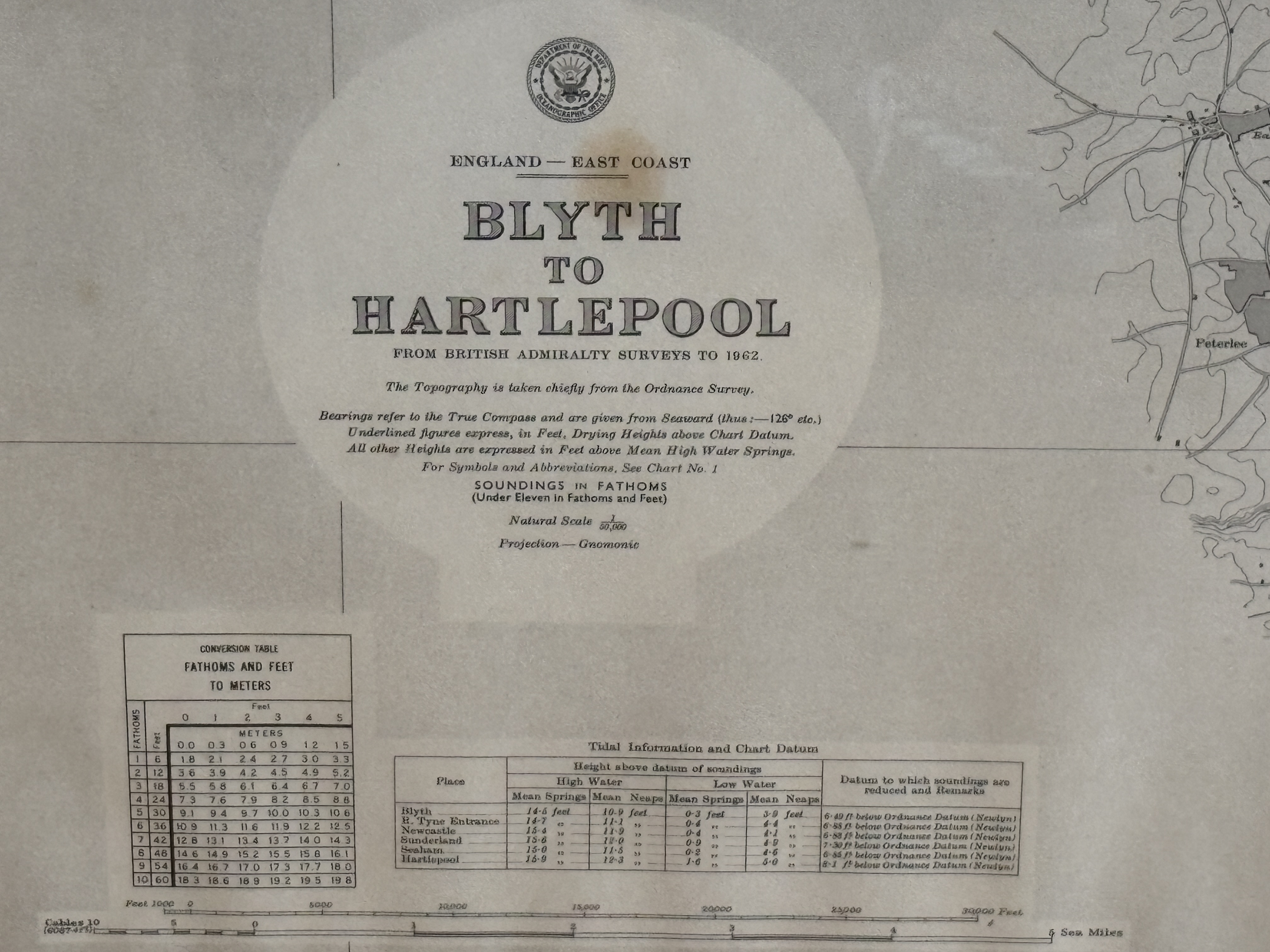
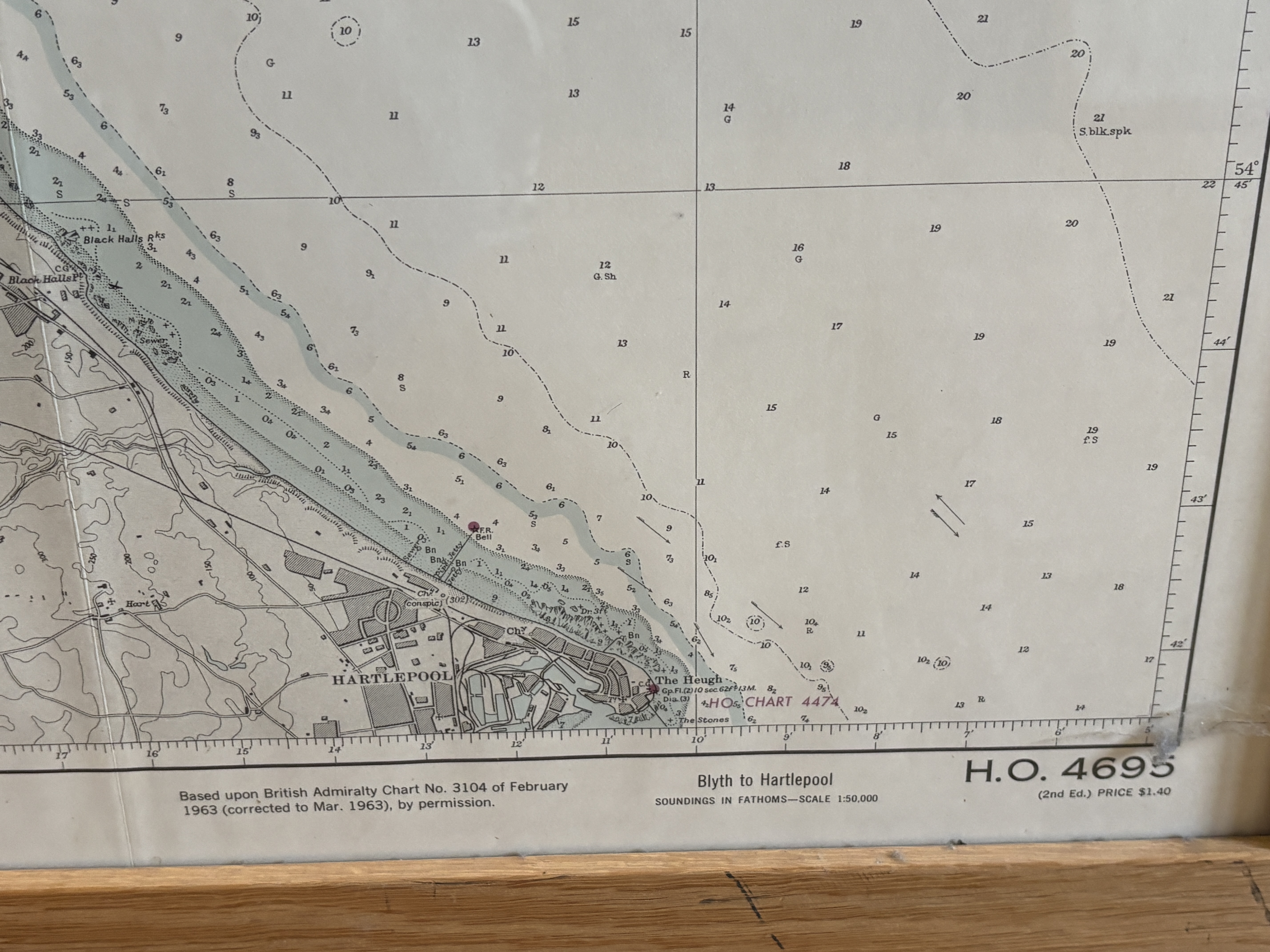
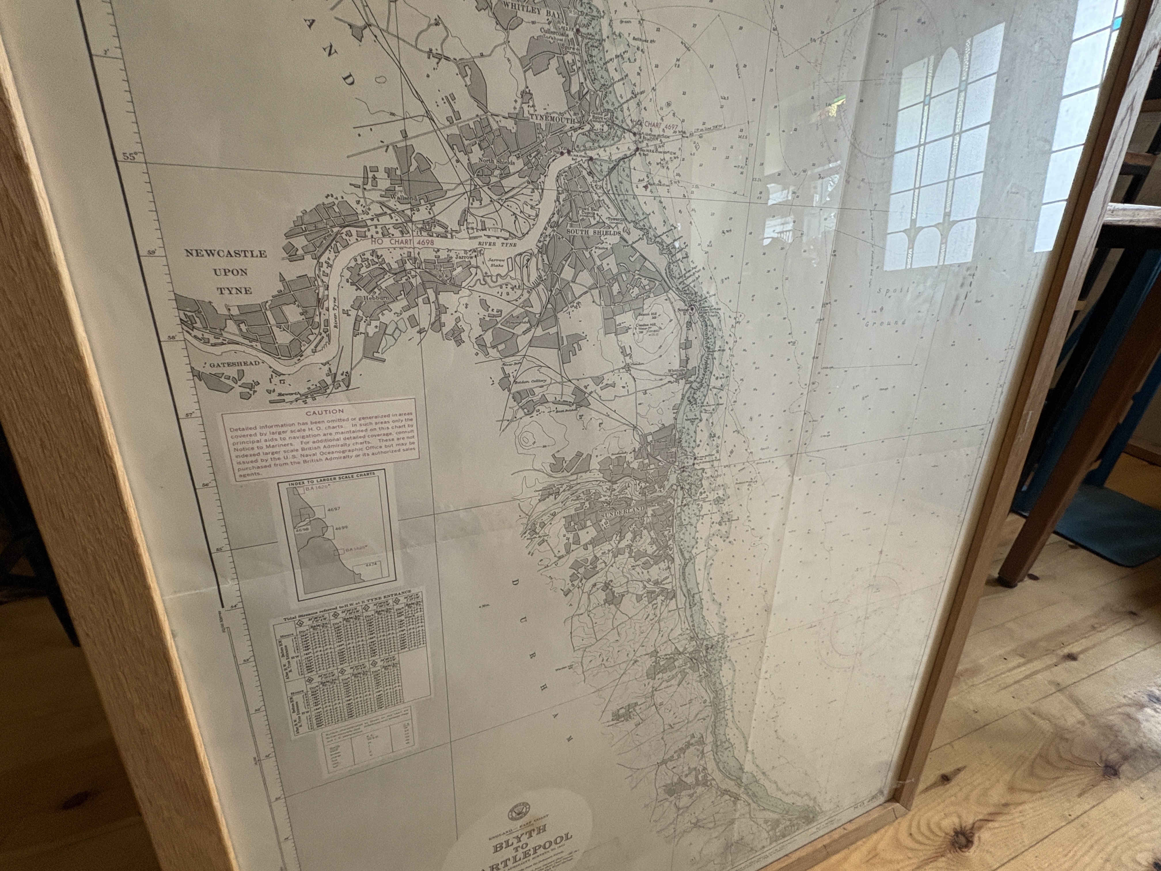
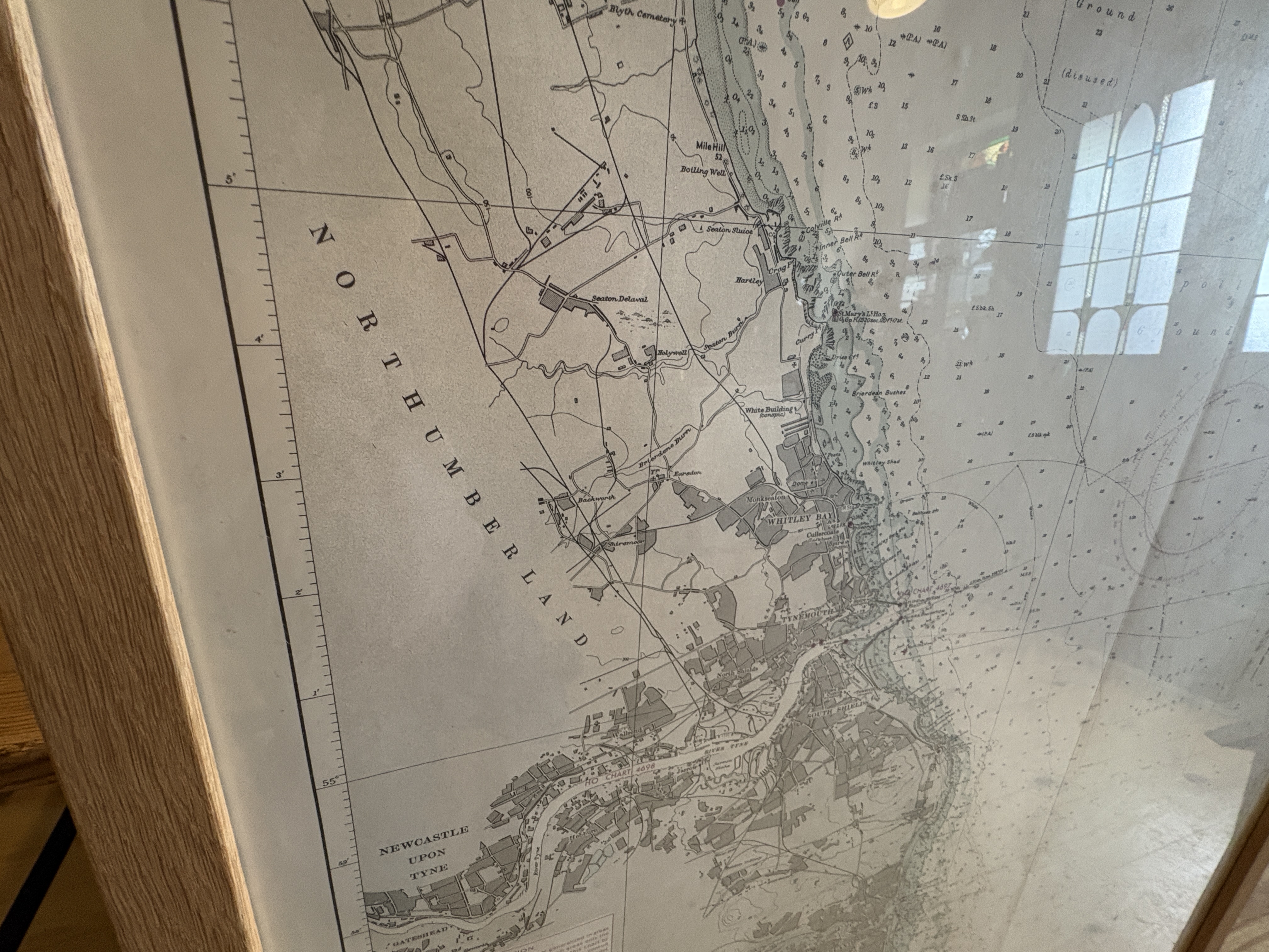
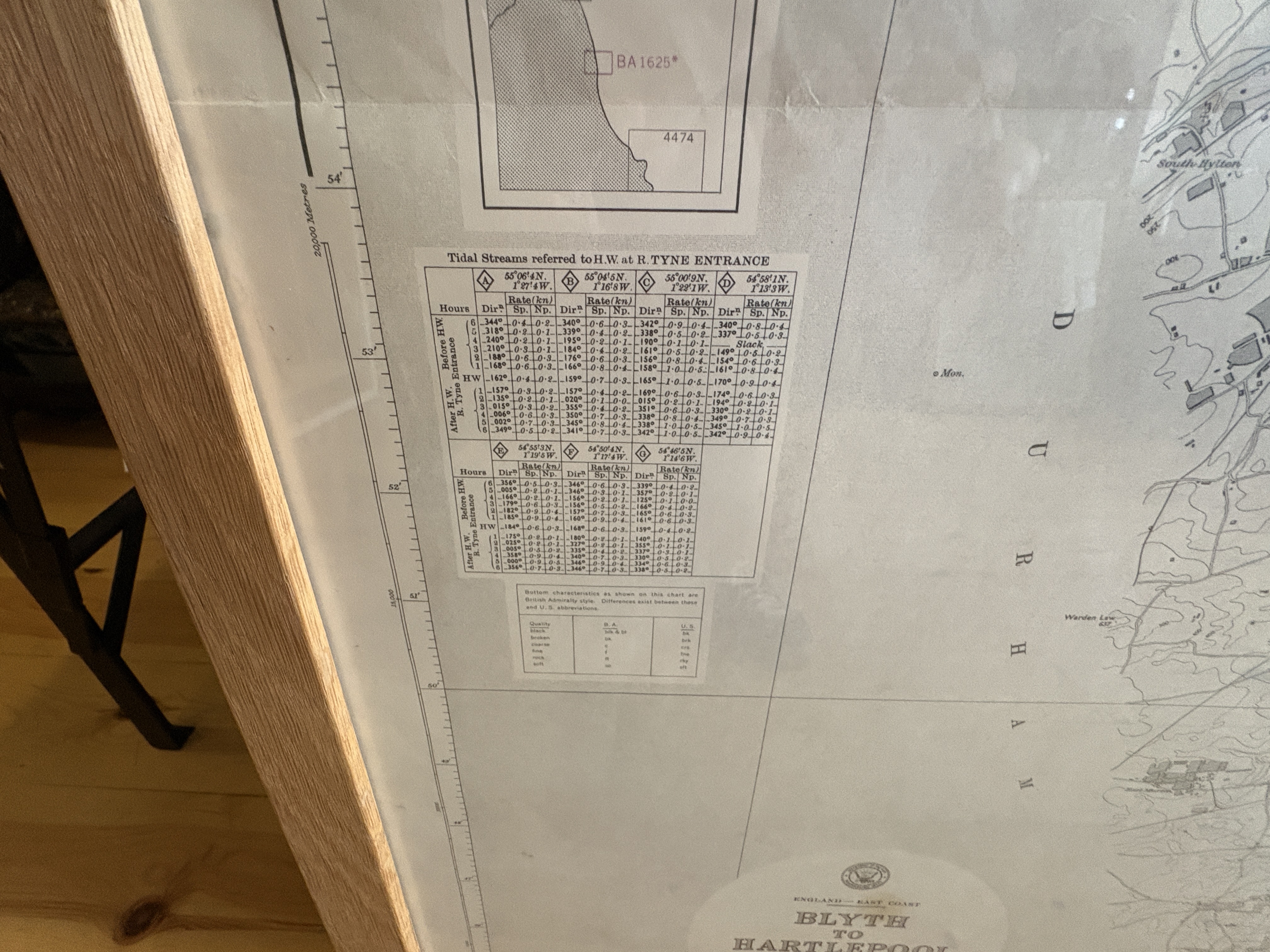
A large-format official nautical chart, H.O. 4695, 2nd Edition, titled Blyth to Hartlepool (England – East Coast). Issued by the U.S. Hydrographic Office (H.O.), this chart is based upon British Admiralty Surveys to 1962 and specifically derived from British Admiralty Chart No. 3104 of February 1963 (corrected to March 1963). The chart details the coastline and offshore waters of Northeast England, covering the area from Blyth southward past Newcastle upon Tyne and Sunderland to Hartlepool. The scale is 1:50,000, with soundings listed in Fathoms. The chart includes complex navigational data, tidal information, and a conversion table from fathoms and feet to meters. The original listed price was $1.40. The chart is currently presented as a single sheet, professionally mounted and displayed flat in a modern, light oak wooden frame behind glass, enhancing its visual appeal and preservation.
Measurement: 78 x 110 CM
Share this lot: